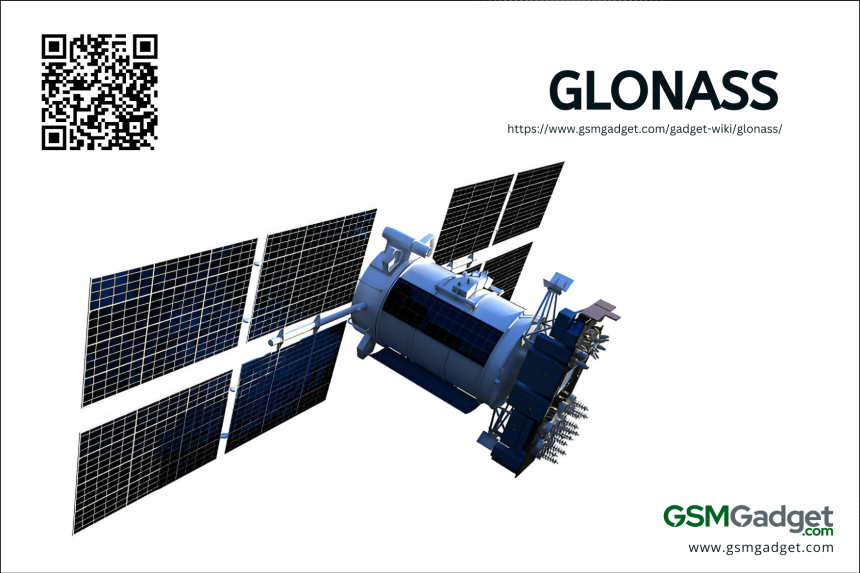
GLONASS, or Global Navigation Satellite System, is Russia’s version of GPS. It gives real-time location, navigation, and timing all over the world for both military and civilian use. Started in 1976 and first launched in 1982 by the Russian Aerospace Defence Forces, it has a group of satellites that let at least four be seen from any place on Earth. GLONASS is very accurate and an important part of the global navigation satellite system. It makes sure we always have access to these services. Even though it has fewer satellites and wasn’t as accurate as GPS before, GLONASS is really good in the Northern Hemisphere. It’s key for many things like getting around, measuring land, and keeping track of time.
How is GLONASS different from GPS?
GLONASS, Russia’s version of GPS, has a satellite system that gives up-to-date location and timing info. It works really well in the far north. Its satellites are higher and tilted differently than GPS, which means better coverage and accuracy where GPS might not do as well. GLONASS uses a different method to prevent signal mix-ups by giving each satellite its own frequency. This can make it more precise in some cases. With its 24 satellites, GLONASS adds to the 31 satellites of GPS. Together, they make global navigation more accurate. When devices use both systems, users get even better location data.
Different versions of GLONASS
GLONASS, Russia’s satellite navigation system, has seen many upgrades since it started. With each new version, it gets more accurate and reliable. It also works better with other navigation tech. Let’s look at the different GLONASS versions that have come out over time.
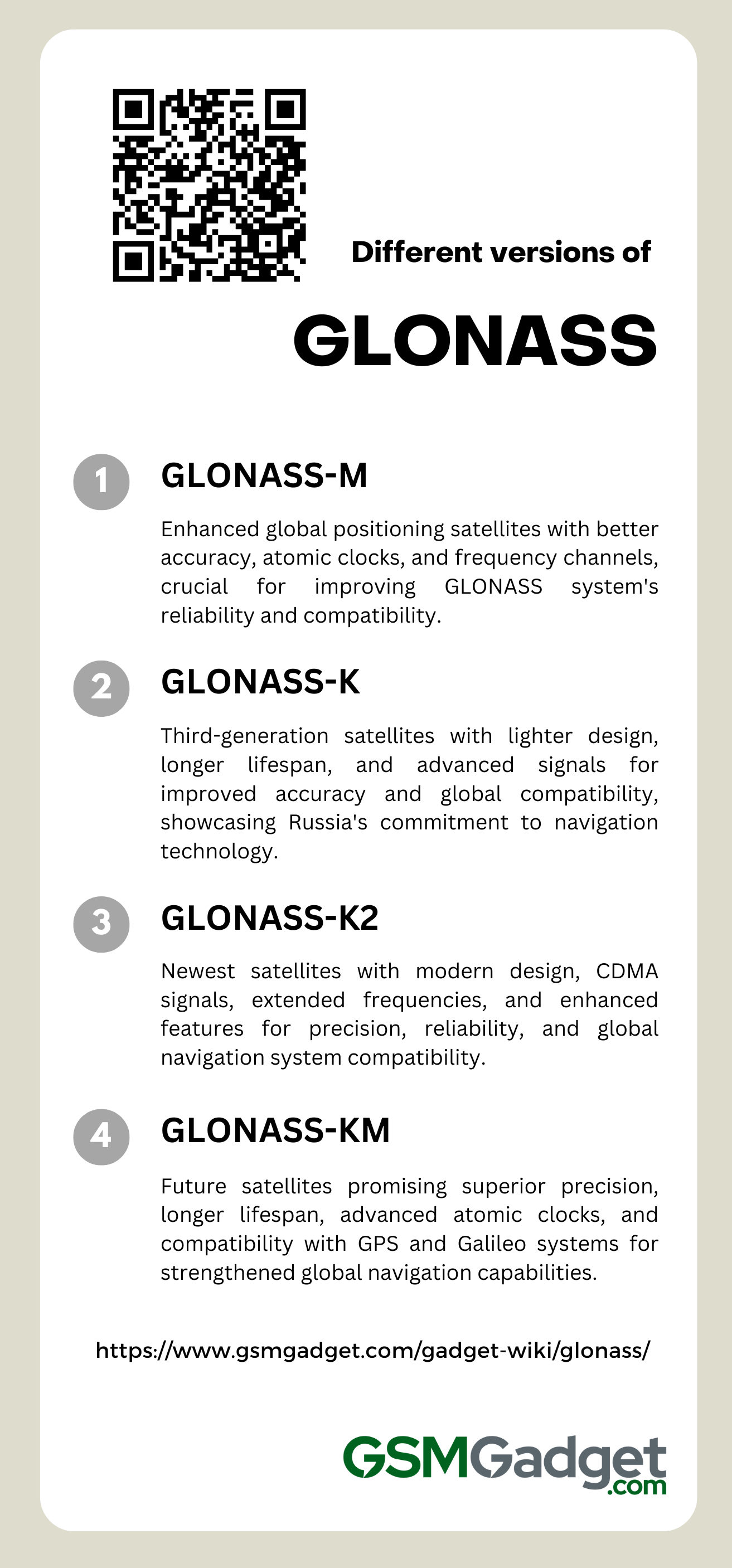
1. GLONASS-M
GLONASS-M, Russia’s upgraded satellite navigation system, came out in the early 2000s. It made global positioning better. These satellites work for seven years and are more accurate because they have better atomic clocks and more frequency channels. They use both L1 and L2 frequency bands. Later models also send a CDMA signal on the L3OC frequency, which is an update from the old FDMA signals. The new “L2” signal for civilians lets dual-frequency gear get even more precise and fix errors caused by the ionosphere. This series has been key to keeping the GLONASS system up-to-date. It works well with other systems like the US GPS, especially because it gives good service and coverage near the poles. With its 51st satellite launched in November 2022, GLONASS-M shows Russia’s 20-year effort to improve satellite navigation.
2. GLONASS-k
The GLONASS-K series is a big step forward for Russia’s GLONASS satellite navigation system. These new third-generation satellites, made by ISS Reshetnev, bring many improvements. They have a lighter design without needing pressurization, which cuts their weight down to 935 kg. This change means we can launch two at once. Plus, they can last up to 10 years in space. These satellites are also better because they’re more accurate and have new signals for things like civil aviation. The L3 and L5 frequency bands they use are great at avoiding signal interference. The GLONASS-K2 model goes even further. It sends out new CDMA signals on several frequencies. This makes it even more precise for people all over the world and gives better time information for different systems. All these upgrades show a huge jump in technology and design. They prove that Russia is really committed to improving its spot in the world of global satellite navigation.
3. GLONASS-K2
The GLONASS-K2 is the newest addition to Russia’s GLONASS navigation system. It’s a big step up from the older Uragan, GLONASS-M, and GLONASS-K models. These satellites have a fresh design that doesn’t need pressurization and new features. For example, they use CDMA signals along with the usual FDMA ones. This makes the system more accurate and reliable. These satellites orbit the Earth at a medium distance and can last for 10 years. They also work with extra L3 and L5 frequencies. This helps them get along better with other global systems, making the whole world’s navigation setup stronger and more precise. GLONASS-K2 satellites come with powerful solar panels, a top-notch system to control their temperature, and can help with international search and rescue missions through COSPAS-SARSAT. Some even have extra gear for military use. Despite facing sanctions, Russia has kept improving these satellites by using home-made parts, showing how tough the GLONASS-K2 program is.
4. GLONASS-KM
The GLONASS-KM is at the cutting edge of Russia’s GLONASS satellite navigation system. It’s set to bring top-notch precision and reliability for satellite navigation. This new version will likely outdo its predecessors with better satellite tech, a longer life, and advanced atomic clocks on board. It’ll also have more navigation channels. The GLONASS-KM is made to work with GPS and Galileo, making the global navigation satellite system (GNSS) stronger. It will improve many things, like pinpointing locations and aiding search and rescue operations. Expected to launch after 2025, the GLONASS-KM satellites will use both CDMA and FDMA signals. This will make them more compatible with other systems. They’re building on the progress of the GLONASS-K and GLONASS-K2 satellites. These brought in lighter satellite buses and might even bring better atomic clocks for greater accuracy, stability, and performance.
Applications of GLONASS
GLONASS is super useful in lots of areas. It helps with better navigation in places that are hard to reach and is a big help in precision farming. This satellite system is really important for today’s tech, both for everyday folks and the military. Let’s look at some main uses of GLONASS:
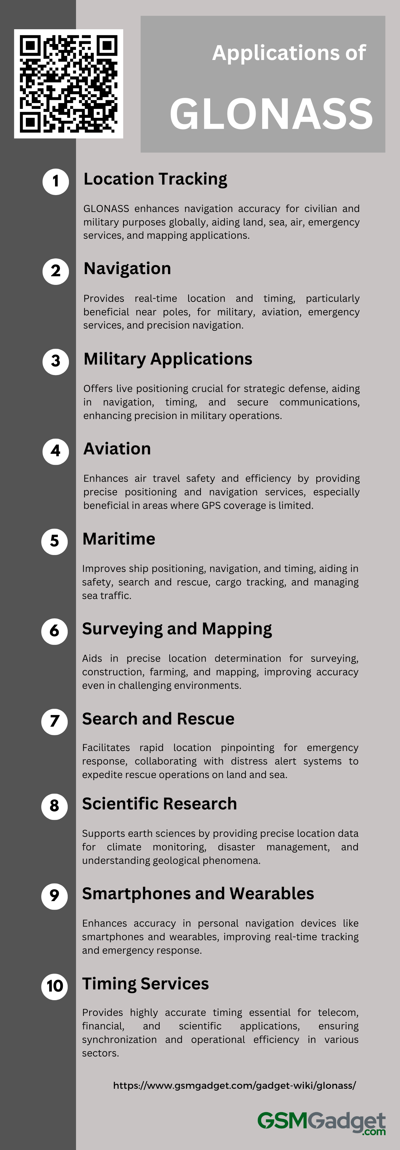
1. Location Tracking
GLONASS is key for location tracking, offering a strong alternative to GPS with real-time position and timing from its satellites. It’s important for many areas, improving navigation accuracy for civilian and military use on land, sea, and air. It also helps in personal devices like smartphones and fitness trackers. When used with GPS, GLONASS boosts location accuracy, especially in high latitudes and tough spots. It’s crucial for emergency services too, helping search and rescue teams find people faster. Plus, its coverage up north and geodesy advances make it vital for GIS, surveying, and mapping. This shows how important GLONASS is for accurate land maps and global infrastructure development.
2. Navigation
GLONASS plays a key role in today’s navigation world. It gives us important real-time location and timing info for many uses. It’s really good at covering areas near the poles, so it’s a trusted source for pinpointing locations. This helps both military and everyday activities. When GLONASS works with systems like GPS, it makes finding your way even more accurate. This is super important for planes setting their course, ships at sea, and even our car navigation systems. Plus, its exactness is crucial for quick emergency help, rescue missions, and earth science studies. GLONASS is truly vital for tasks that need high accuracy, like making maps and checking land measurements in our techy world.
3. Military Applications
GLONASS is key for military tech, giving exact locations needed for a strategic edge in defense. Its satellites offer live positioning and speed info, which is vital for guiding military stuff like planes and smart bombs. The system improves navigation, timing, and teamwork. It helps guide bombs, line up troop moves, and set up secure comms that are hard to jam. Working with other systems like GPS makes GLONASS even more reliable and sharp. This helps armies navigate and aim well, even in tough spots like Syria. Using both systems is super important for modern military plans that rely on space tools for better precision and success.
4. Aviation
GLONASS plays a key role in making air travel safer and more efficient. It works with GPS to provide top-notch positioning, navigation, and timing services. This is really important for tasks that must be super safe. GLONASS helps planes stay on track, pick the best routes, and land better, especially where GPS might not reach well. By blending GLONASS with flight systems, pilots always know what’s going on around them. This helps prevent crashes and keeps the skies running smoothly. When GLONASS or GPS has had problems in the past, this teamwork has kept flights moving without trouble. It shows how important GLONASS is for managing air traffic worldwide and keeping everyone flying safe. Using both GLONASS and GPS together means planes can fly straighter paths and manage traffic better. This saves fuel and is better for the environment.
5. Maritime
In the maritime world, GLONASS is key for ships to find their way. It makes the positioning, navigation, and timing (PNT) of ships much better. When GLONASS works with other systems like GPS, sailors get even more accurate info. This is super important for safe travel in tough waters. The combo helps a lot with search and rescue, keeping track of cargo, and finding the best ways to go. This means quick help and smarter shipping. GLONASS is also great up near the poles because its satellites cover those areas well. This helps tracking devices and navigation tools work better in far-off places. Plus, it’s part of the Automatic Identification System (AIS), which lets us see where ships are and what they are in real time. This helps manage sea traffic and keeps an eye on the ocean for people in charge and those steering the ships. So, all kinds of boats, from big freighters to small ones, get to use top-notch location info. This helps everyone sail safely and efficiently.
6. Surveying and Mapping
GLONASS is a satellite navigation system that’s as precise as GPS and very important for surveying and mapping work. It has many satellites that help improve how well it can pinpoint locations all over the world. This makes surveying tools more accurate, even in tough spots like city streets with tall buildings or places with lots of trees and hills. When GLONASS works together with other navigation systems, it gets even better at measuring things accurately. This is super important for jobs that need exact measurements, like when people map out property lines, manage construction sites, or farm with high precision. By using GLONASS and systems like GPS together, surveyors can map land, plan new buildings, and study the Earth with measurements that are really close to perfect, down to just a few millimeters. This helps with many kinds of projects that we all rely on.
7. Search and Rescue
GLONASS is key in search and rescue missions because it helps find people fast with its precise satellite location. It’s really good at pinpointing spots, especially in tough places, to help those who need help right away. The system works with the Cospas-Sarsat distress alert system to quickly spot and send out signals for help, making rescue teams get moving faster. Plus, GLONASS’s spot-on location services are super important for getting emergency folks to where they’re needed, on land or sea. This helps cut down the time it takes to respond and can save lives. When GLONASS teams up with other satellite systems like GPS, it makes finding locations even more accurate. This makes it a big deal for helping out in emergencies and dealing with disasters.
8. Scientific Research
GLONASS plays a big role in science, giving us precise location data for studying our planet. It helps track climate change by measuring sea levels, ice, and the air. For places near the poles, it’s really good at helping us understand those areas and things like space weather. Scientists use GLONASS to watch how Earth’s plates move, which can help predict earthquakes and check out natural dangers. When we combine GLONASS with other systems like GPS, we get even better data. This makes it easier to keep an eye on how continents shift. By working together, these systems make it easier to manage the environment and handle disasters. They also let scientists explore more and take care of our planet better. This teamwork is a big step forward for earth sciences.
9. Smartphones and Wearables
In the world of global navigation, GLONASS plays a big role. It makes location services in smartphones and wearables more accurate and reliable. When used with GPS, it gives even better results. This is especially true in places like cities where tall buildings can block signals, or near the poles. Devices like fitness trackers and smartwatches use GLONASS to give precise tracking for sports and outdoor activities. This is super important for mapping out routes and in emergencies, like when someone needs to be found quickly. Thanks to its wide coverage and fast signal pickup, GLONASS is a key part of modern smartphones and wearables. It helps with real-time location tracking and improves how we use personal navigation and fitness apps.
10. Timing Services
GLONASS’s timing services are super important for many key areas because they have really accurate atomic clocks. These clocks give us time down to the nanosecond. This kind of accuracy is a big deal for keeping telecom networks, financial trades, and power grids running right. They need to be in sync, work fast, and stay stable to avoid problems like fraud. In tech, GLONASS helps devices talk to each other without delays and keeps everything on schedule. Scientists also use it when they need to do experiments all over the world at the same time. Plus, it’s great for helping out in emergencies by giving exact times that help with rescue plans and figuring out what happened when. Both military and everyday navigation systems work way better because of the precise timing from GLONASS.
Advantages of GLONASS
GLONASS, Russia’s own satellite navigation system, has some cool perks. It’s set up high in orbit and uses a special method called frequency division multiple access (FDMA). This means it can give better location info, especially up near the North and South Poles where GPS might not work as well.
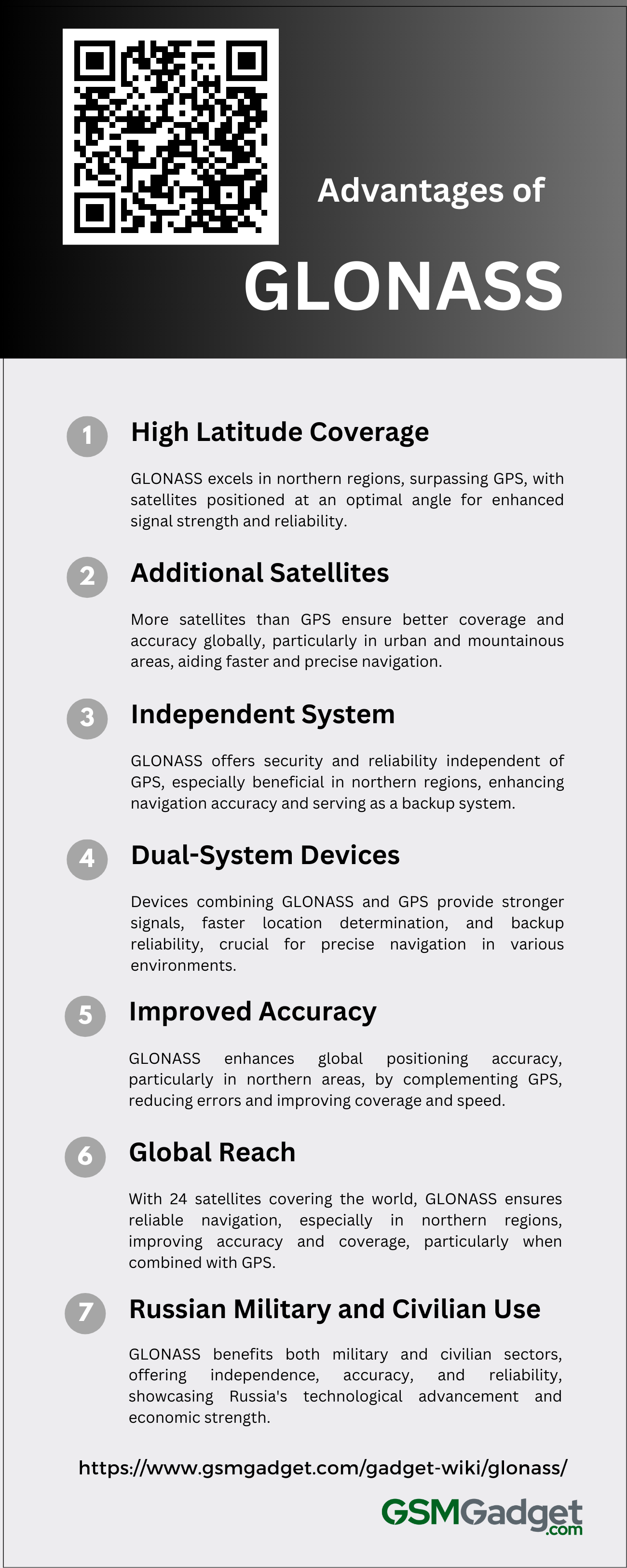
1. High Latitude Coverage
Russia’s GLONASS satellite system is great for tracking locations in the far north. It does better than GPS around the Earth’s poles. The satellites are set up at a 64.8-degree angle, which helps give a strong signal and clear view of the sky in places like Russia, Scandinavia, Canada, and the Arctic. This setup means people can always get good info on where they are, how fast they’re moving, and the time, which is super important for flying planes, sailing boats, and doing science stuff. GLONASS is really reliable, especially where GPS might not work well. So, it’s a solid choice for finding your way or keeping time in far-off or very cold places.
2. Additional Satellites
GLONASS, made by Russia, is like GPS but has extra satellites. This makes it better at covering and pinpointing locations, especially up north where GPS might not work as well. It has 24 satellites in three different paths in space, so you can always see at least four of them from anywhere on Earth. This helps give more accurate info on where you are, how fast you’re going, and the time. It’s really helpful in cities with tall buildings and in the mountains because it finds satellites faster and gives better directions. The way the satellites are set up also means less error in figuring out your position. If you use devices that have both GLONASS and GPS, you get even better results. They find your location quicker and make sure the navigation services are strong and dependable all over the world.
3. Independent System
GLONASS is an independent navigation system that offers better security because it doesn’t rely on the American GPS. Its satellites are positioned at a higher angle in the sky, which means they work really well in places far to the north where GPS isn’t as good. This is great for folks living or working up there. When GLONASS and GPS are used together in the same device, they make location tracking faster and more precise. This is super important for things like planes, boats, and military stuff. Plus, having GLONASS around gives us a backup plan in case something goes wrong with GPS. It makes sure we can always know where we are, which keeps our global navigation systems strong and dependable.
4. Dual-System Devices
Devices that use both GLONASS and GPS give you better navigation all over the world. They pull strength from two sets of satellites, so you’re not stuck with just one system. This means you get a stronger signal, especially in places far up north or in cities with tall buildings where GLONASS is really good. Having two systems also means if one has issues, you still have a backup for a steady and reliable location. Plus, more satellites help your device find where you are faster. This is super important for jobs that need quick and precise responses. For folks traveling across countries or working in tough spots, these dual-system gadgets make sure you have a solid and exact way to know where you are.
5. Improved Accuracy
The Global Navigation Satellite System (GLONASS) boosts the accuracy of global positioning, competing with the United States’ GPS. GLONASS satellites use special orbits that work well with GPS, giving better precision and less signal blockage from city buildings and natural features. This system is especially good in places far to the north because of its high orbital tilt, which means folks up there can count on it for getting around. When used with GPS, GLONASS can pinpoint locations within 5–10 meters horizontally and within 15 meters vertically. This teamwork cuts down mistakes by about 10% side-to-side and 15% up-and-down. It also makes coverage better and finds your spot faster in tricky spots like city streets surrounded by tall buildings. Together, GLONASS and GPS offer a strong and reliable way to navigate all sorts of different areas.
6. Global Reach
GLONASS, Russia’s satellite navigation system, covers the whole world with its 24 satellites. It is really good at giving users solid satellite navigation, especially up north where it’s better than other systems. The way its satellites orbit at a 64.8-degree angle makes sure that even faraway and icy places get good signals and accurate locations. When you use GLONASS with GPS, it gets even better. You can see more satellites and know your position more accurately, which is great for things like the military, emergencies, flying planes, and sailing ships. Combining these two can give you up to 20% more satellites to use, which is super important when you need to be very precise and depend on your navigation tools.
7. Russian Military and Civilian Use
GLONASS, Russia’s answer to the US GPS, provides big benefits for both military and everyday use. It gives the Russian military a reliable tool for navigating, aiming weapons, and coordinating troops. Plus, it works without relying on other countries’ satellites. This is super important for keeping their satellite navigation safe, even when there are global tensions. For regular people, GLONASS makes things like emergency services, getting around town, and using maps on phones more accurate. When it works with other satellite systems, it gets even better, especially up near the North and South Poles where its signal is stronger. Companies and cars using GLONASS show that Russia is growing its tech independence and economic strength. Also, when GLONASS and GPS signals are used together, they make finding locations anywhere in the world even more precise.
Limitations of GLONASS
GLONASS, Russia’s satellite navigation system, has made big strides in global positioning. But it’s got some limits that can impact how well it works in some situations. Here’s a rundown of the main issues to keep in mind if you’re using or building stuff with GLONASS.
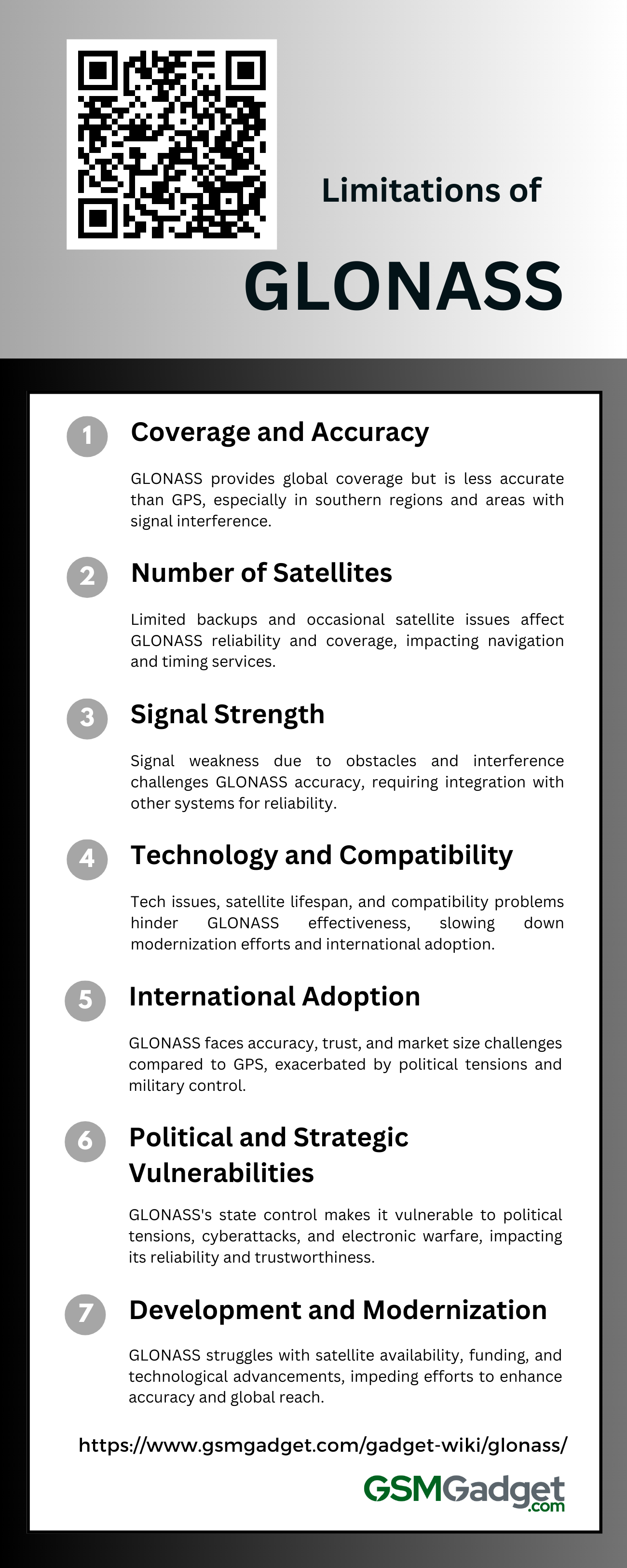
1. Coverage and Accuracy
GLONASS, Russia’s satellite navigation system, covers the whole world but isn’t always accurate. It works best in the Northern Hemisphere where it has more satellites. Near the equator and in the Southern Hemisphere, it’s not as good because there are fewer satellites. Usually, GLONASS can tell your location within 5-10 meters, while GPS is a bit better at 3.5-7.8 meters. Things like tall buildings, mountains, signal blocks, and jamming can make GLONASS less precise. The type of receiver you have and using other navigation systems with it can help make it work better. But, since there aren’t many support stations outside of Russia, GLONASS might not be as reliable everywhere.
2. Number of Satellites
The GLONASS satellite navigation system aims to cover the whole world using 24 satellites. But it has a small backup, so accuracy might drop and service could be interrupted when satellites are being fixed or break down unexpectedly. GPS has extra satellites which makes it more reliable and accurate. Because GLONASS doesn’t have many backups, its service isn’t always strong or even, especially where the sky view is limited. Even though there’s work to keep enough satellites up there, problems have sometimes made the network less effective. As of February 2024, with 24 out of 26 satellites working, GLONASS just barely covers the whole globe. This shows how easily things can go wrong and affect users who rely on GLONASS for navigation and timing.
3. Signal Strength
The Global Navigation Satellite System (GLONASS) is like GPS but has some issues with signal strength. Tall buildings in cities, areas far up north with fewer satellites, and disturbances in the atmosphere can all make the signal weaker. This leads to less accurate location info, which is important for tasks that need high precision. GLONASS uses a system called Frequency Division Multiple Access (FDMA), which can face more interference and signal changes than GPS’s Code Division Multiple Access (CDMA). The way GLONASS satellites orbit helps service in the far north but can cause weaker signals down south. Also, having only a few frequency channels means it’s easier for the signals to get jammed or interfered with. To deal with these problems, people often combine GLONASS with other systems to make navigation data more reliable and exact.
4. Technology and Compatibility
GLONASS, Russia’s satellite navigation system, faces some tech problems and doesn’t always work well with other systems. Its satellites don’t last as long, so they need to be replaced more often, which might cause service breaks. Near the equator, GLONASS isn’t as accurate because of how its satellites move. It also has trouble working with systems like GPS because they use different signals, and you might need extra gear to make them work together. Even though there are plans to fix these issues by using CDMA signals, it’s taking a while, and many satellites are still being used even though they’re old. Plus, not having enough info on the satellites’ looks and shapes makes it hard to track their paths accurately, limiting how good GLONASS is for jobs that need really precise location info.
5. International Adoption
GLONASS, a global navigation satellite system, faces challenges in becoming widely used. It’s not as accurate as GPS, which is important for those who need precise navigation and timing. People also worry about relying on it because the Russian government controls it, and there are political tensions. The market for GLONASS devices isn’t as big as for GPS, making it less attractive. There have been times when its service was down and satellites weren’t available, though it was fully fixed in 2011. Some countries like China, Brazil, India, and Belarus work with GLONASS, but it’s still behind GPS in how much it’s used and found in products. Since it’s used for both civilian and military purposes, there’s extra concern about depending on a system run by the military, which makes it harder for GLONASS to be accepted around the world.
6. Political and Strategic Vulnerabilities
GLONASS, Russia’s version of the GPS, faces political and strategic issues that can mess with its reliability and how much the world trusts it. Since it’s controlled by the state, any changes in Russia’s international relations can lead to service problems or shutdowns during diplomatic troubles. This is worrying for countries that depend on GLONASS for important location services. They risk the system being messed with or cut off when conflicts arise. Past problems with signal errors from software issues have shown how politics and tech challenges can affect GLONASS. Also, cyberattacks and electronic warfare are big threats to how well it works and its security. These problems, along with competition from other navigation systems, not only hurt how well GLONASS operates but also make people trust it less. This affects its place in the satellite navigation market and shows the risks of using it internationally.
7. Development and Modernization
The GLONASS navigation system is key for global positioning but faces many challenges. It has had problems with not enough satellites, which caused limited coverage and accuracy issues. GLONASS has also dealt with money problems and old tech that slow down improvements to its satellites and ground support. The satellites don’t last long, so they need updates often. There are plans to make GLONASS work better with systems like GPS and to use newer CDMA signals in the GLONASS-K satellites. But these plans get tricky because of the old tech, most ground stations being in Russia, and international sanctions. Even with new efforts to make it more precise and wide-reaching, GLONASS is trying hard to stay up-to-date in a world where satellite navigation technology moves fast.