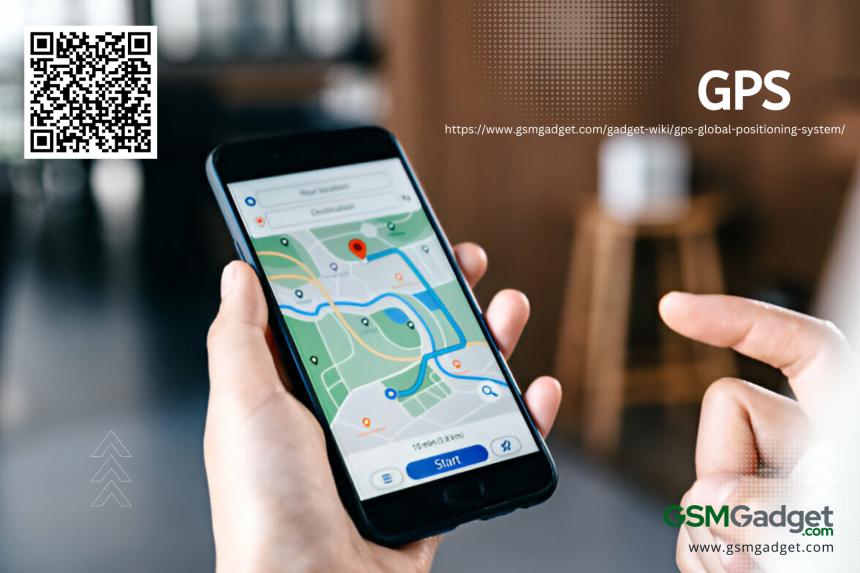
The Global Positioning System (GPS) is a satellite-based tool made by the U.S. Department of Defense. It has changed how we find our way and know where we are in the world. This system uses a bunch of satellites to give exact location and time info to GPS devices, no matter the weather. This lets us know our spot on the globe with great accuracy. GPS is used in many areas, like for civilians, the military, and science. It’s key for measuring the Earth’s shape to help with natural disasters and for making sea travel safer with better navigation tools. GPS is everywhere – in planes, farms, emergency services, and even when you’re just getting around town. It’s a big part of today’s navigation systems.
How does GPS Works?
The Global Positioning System (GPS) is a satellite-based system that tells you your exact location and time on Earth. It needs a clear view of at least four satellites to work well. The United States government runs it, and it has at least 24 satellites flying about 20,200 kilometers above us. These satellites send out special signals. GPS receivers use these signals to figure out where they are this includes their latitude, longitude, and altitude. They do this by a method called trilateration. Here’s how it works: the receiver measures how long it takes for the satellite signals to reach it. Then it knows how far it is from each satellite. With that info, it can tell you exactly where you are. Even though there are some issues like clock errors and signal bounces, technology has made GPS really accurate now. GPS is super important for many things. We use it to get around in cars, grow crops better, keep track of time in banking, and help find people who need rescuing.
History and Development of GPS (Global Positioning System)
The Global Positioning System (GPS) was first made by the U.S. Department of Defense in the 1960s for military use. It has since turned into a global system that everyone uses for lots of different things. By 1993, GPS had 24 satellites and was fully ready to go. Now, it’s key in many technologies, like smartphones. They use GPS to give us exact location, speed, and time info. Even though it was hard at first because of money issues and security rules, letting everyone use GPS in the 1980s changed technology big time. It got better over time and now works with other satellite systems like GLONASS and Galileo. Today, GPS is super important not just for getting around but also for things like trains. It helps figure out where trains are and how fast they’re going. Sure, it costs a lot to set up these special satellite systems, but they’re really important for specific jobs.
Types of GPS
GPS has changed how we find our way and know where we are in the world. There are many kinds of GPS systems out there, each with special features and uses. Let’s look at the different types of GPS:
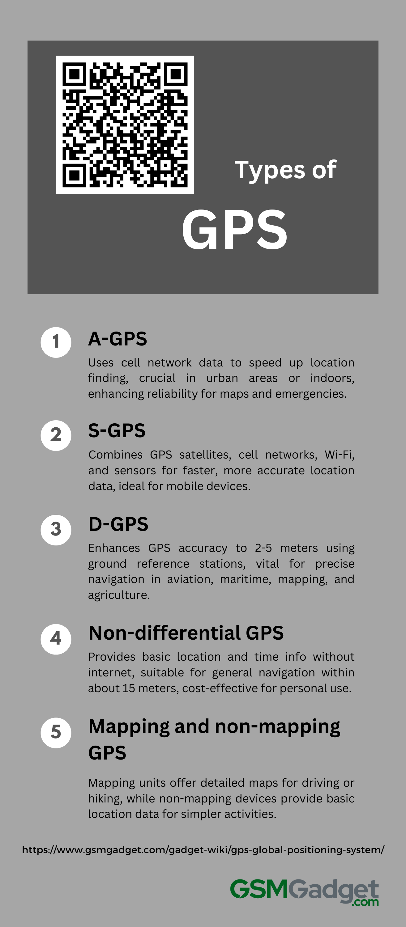
1. A-GPS
Assisted Global Positioning System (A-GPS) is a GPS boost that uses cell network data to speed up and improve finding a location. It taps into the power of nearby cell towers, cutting down the time it takes to get a first fix (TTFF). This is super helpful in places where it’s hard to see satellites, like cities or inside buildings. A-GPS combines satellite and cell data so devices can find their spot fast and right on target. This is key for things like maps, emergency help, and other services that need your location. With A-GPS built into phones, people get a more reliable and quick way to know where they are, even in tough spots.
2. S-GPS
Simultaneous GPS (S-GPS) is a high-tech system that makes traditional GPS work better. It uses signals from both GPS satellites and cell networks at the same time. It also uses info from Wi-Fi, cell towers, and the device’s own sensors. This method speeds up how fast you get your location and makes it more accurate. It’s really helpful in tough spots like city streets with tall buildings or inside where satellite signals can be weak. S-GPS is great for smartphones and other portable gadgets that need quick and exact locations for things like maps, help in emergencies, and apps that use your location. By pulling together different kinds of data, S-GPS gives a reliable way to know where you are, even if you’re always moving around. This is super important for finding your way, getting help when you need it, and keeping track of things.
3. D-GPS
Differential GPS (D-GPS) boosts the accuracy of regular GPS, cutting down the usual 15-meter error to about 2-5 meters in most situations. This improved system relies on a network of fixed reference stations on the ground. These stations spot the differences between satellite signals and known locations. They then send out correction data. D-GPS receivers use this data to make their location finding better in real-time. With this, there’s a big jump in how reliable and exact the system is. That’s why D-GPS is so important for jobs that need spot-on navigation and timing. Think about aviation, sailing, land measuring, making maps, and farming with precision. By fixing mistakes from things like air changes, clock errors, and other GPS signal issues, D-GPS is changing industries that need accurate location info.
4. Non-differential GPS
Non-differential GPS, also called Standard Positioning Service (SPS), is key for many tasks. These include figuring out speed, fixing satellite images, and simple navigation. This system gives location and time info to a GPS receiver without needing phone or internet service. It must have a clear view of at least four GPS satellites and uses trilateration to pinpoint the location. Although it’s the most basic kind of GPS and can make mistakes due to satellite clock drift, delays in the ionosphere and troposphere, and multipath effects, it still gets you within about 15 meters of your spot for everyday use. Because it’s easy to get and doesn’t cost much, non-differential GPS is a go-to for personal gadgets, travel, mapping tools, and smartphone location services when perfect precision isn’t critical.
5. Mapping and non-mapping GPS
GPS devices are key for getting around and come in two main kinds: mapping and non-mapping. Mapping GPS units have detailed maps and fancy features that help a lot when you need to see where you’re going and plan your route, like when driving or hiking. They also show extra stuff like places to visit and street names for step-by-step directions. On the other hand, non-mapping GPS gadgets give you just the basic info like where you are, how high up you are, and how fast you’re moving. They don’t have a map to look at. These are good for when you only need simple location details, like when treasure hunting with GPS, walking in the woods, or working in jobs like land measuring and farming. Whether you pick a mapping or non-mapping GPS depends on what you need it for, how you want to see the data, and how much detail you need for your activity. Mapping GPS devices change the way we use maps with their cool features, while non-mapping ones are simpler, often cheaper, and have batteries that last longer for just tracking where you are.
Components of a GPS system
A GPS, or Global Positioning System, is a high-tech way to find out where you are on Earth. It uses satellites and special receivers to figure out your exact spot. The main parts of a GPS system work together to give you the right location and time info. The key parts of a GPS system are:
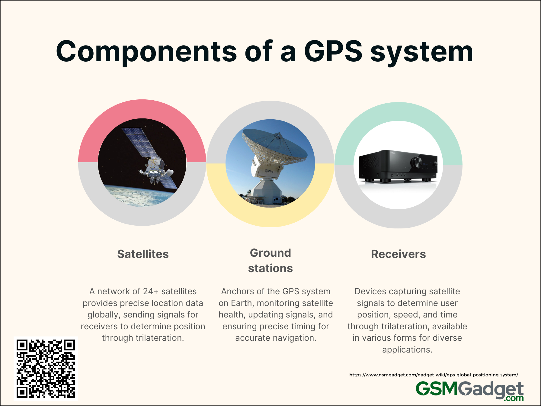
1. Satellites
The Global Positioning System (GPS) is a network of at least 24 satellites that circle the Earth. They give us precise navigation details. The U.S. government runs these satellites, which are set up in six paths to cover the whole globe. This setup means we can see at least four satellites from any spot on Earth at all times. These satellites send out special signals. These include location data and Universal Time Coordinated (UTC). GPS receivers use these signals to figure out exactly where a user is through a process called trilateration. The satellites have super accurate atomic clocks which are key for the system’s dependability. They help with both global navigation and time sharing. GPS satellites are made to work for about 10 years. They get replaced regularly to keep the system working well. GPS is essential for making sure different tech systems work together smoothly.
2. Ground stations
Ground stations are key to the Global Positioning System (GPS). They act as the system’s anchors on Earth, making sure it works well and stays reliable. These stations are placed all over the world. Their job is to watch over the GPS satellites all the time. They gather important info about each satellite’s health, like where it is in orbit, any changes in its clock, and if its signals are good. These stations use super accurate atomic clocks and special GPS receivers. They check the satellite signals to figure out exactly where the satellites are and how they’re moving. Then, they use this info to update what the satellites tell us. This helps our GPS devices figure out where we are more accurately. Also, ground stations keep everything in sync. They make sure the timing from the satellites is super precise, down to a few nanoseconds. By keeping a close eye on things and making updates, ground stations help the GPS give us reliable and exact location, navigation, and time info no matter where we are in the world.
3. Receivers
GPS receivers are key parts of the Global Positioning System. They let users know their exact spot, speed, and time by catching signals from satellites in space. These gadgets use a process called trilateration. This means they measure how long it takes for signals to come from at least four satellites. By doing this, they can work out how far away each satellite is and find the user’s position in 3D very accurately. You can find GPS receivers in many forms, like standalone devices or built into smartphones and cars. They have smart processors and software that give you your location right away. They help with directions and can save maps for later. Plus, they can tell you things like how high you are, how fast you’re going, and which way you’re moving. These features make GPS receivers super useful for lots of jobs. They’ve changed industries that need good navigation, measuring land, and gathering info about the Earth’s surface.
Top GPS software
GPS software is a must-have for getting around and finding places these days. It’s great for everyday folks or businesses. The best GPS software makes things run smoother, more accurately, and keeps you connected. Let’s look at some of the top GPS options that are known for their cool features and strong performance.
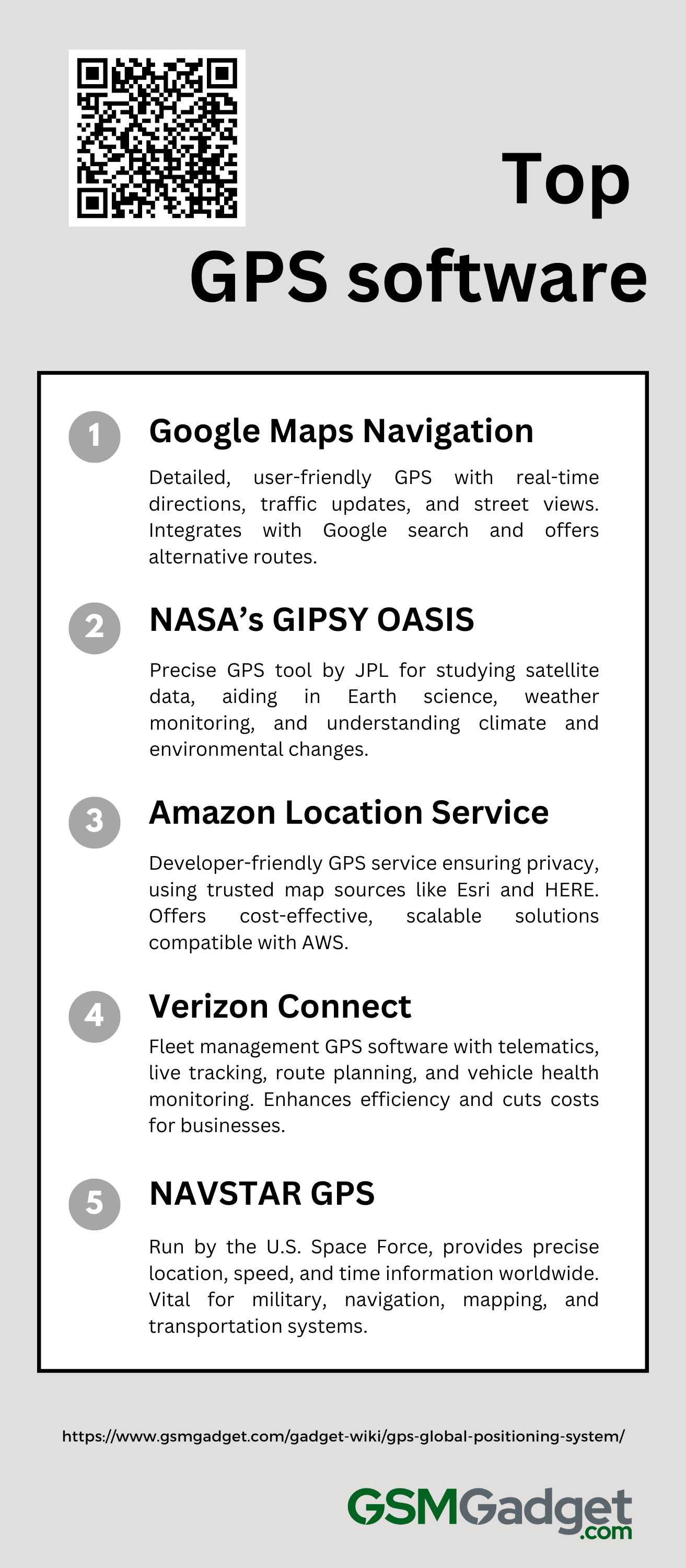
1. Google Maps Navigation
2. NASA’s GIPSY OASIS
3. Amazon Location Service
4. Verizon Connect
5. NAVSTAR GPS
Applications of GPS
GPS has changed how we find our way and interact with the world. Since it started, GPS tech has spread into many areas, changing industries and making our everyday lives better. Here are some key uses of GPS:
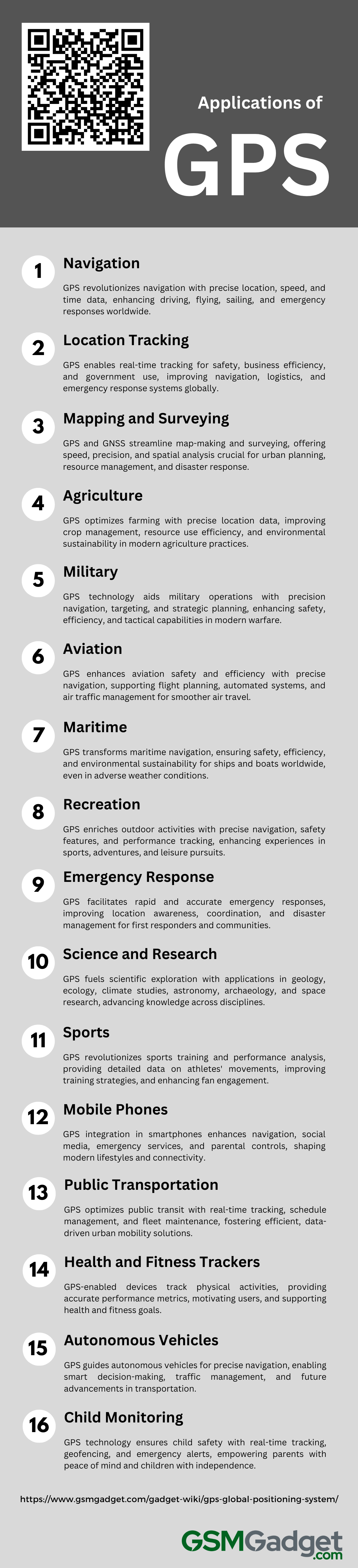
1. Navigation
The Global Positioning System (GPS) has changed the way we navigate. It gives us exact locations and is always on, no matter the weather. GPS tells us where we are, how fast we’re going, and the time – all important for getting around. We rely on it for driving directions, flying safely, sailing, and our transport systems. It helps emergency teams find people quickly, helps make maps, and lets our phones give us location services. As GPS works with other systems like GLONASS and Galileo, it gets even better. This means we’ll have better navigation in the future, making GPS a key part of our world.
2. Location Tracking
The Global Positioning System (GPS) has been a game-changer for tracking locations. It offers many uses that help with personal safety, business work, and keeping our country safe. GPS lets us find exact places in real-time, which is super important for getting around, avoiding crashes, and watching the earth’s movements. It’s part of everyday gadgets like phones and fitness trackers, helping us keep track of activities and making sure our family and friends are safe. In business, GPS makes things like shipping and deliveries better by helping with planning routes, keeping an eye on goods, and confirming when things get where they need to go. This helps companies run smoother and save money. Governments use GPS too, for things like mapping out land and checking on animals in the wild. For emergency services, GPS is really important because it helps rescue teams find people faster when they need help. As GPS gets even better and works with other satellite systems, it will keep improving how we track locations. This will lead to new ways to stay safe and make life easier in lots of different areas.
3. Mapping and Surveying
GPS and GNSS have changed the game for map-making and surveying. They offer top-notch precision and speed. GPS lets mapmakers create very detailed maps and helps surveyors gather land data fast, saving a lot of time compared to old-school manual methods. When you mix GPS with GIS, you get even better at analyzing and showing spatial data. This combo is super useful for city planning, finding your way, keeping an eye on the environment, and managing resources. It’s also key for responding to disasters and building new stuff. GPS is also important for setting up control points in aerial photos and doing RTK surveys that need to be super precise, down to the centimeter. This is really important for building projects, taking care of land, and monitoring the environment. By bringing together GPS and GIS tech, we now have maps that are interactive, can be updated, and are full of useful info. This has really changed how surveying and mapping work.
4. Agriculture
GPS technology has changed farming into a high-tech field that focuses on being precise and eco-friendly. By using Global Navigation Satellite System (GNSS) tools, farmers get exact location details. This helps them map their fields, check crops, and use resources better. They can apply water, fertilizers, and pesticides more accurately with GPS, which saves resources and is better for the environment. GPS in tractors and combines means planting and harvesting are done just right, cutting down on waste and fuel by avoiding redoing areas. Plus, when GPS data is used with Geographic Information Systems (GIS), it improves soil and crop studies. This leads to smarter farming choices. Using GPS in agriculture boosts how much food is grown and helps save important resources, making a big difference in how well the industry does.
5. Military
GPS technology is crucial in military operations. It provides precision and better awareness, which are key for modern tactics. GPS helps soldiers navigate tough places, use guided weapons with less harm to others, and plan complex tasks accurately. It’s important for aiming, saving lives, and managing facilities, especially for artillery accuracy. When combined with secure communication and drones, GPS changes how we do reconnaissance, surveillance, and fighting. It gives a full picture of the battlefield and helps coordinate quick actions. As GPS gets better, it will keep improving how the military works, stays safe, and stays ahead in strategy.
6. Aviation
In aviation, using Global Navigation Satellite Systems (GNSS), like GPS, has changed the game. These systems support tech such as Performance Based Navigation (PBN) and Automatic Dependent Surveillance Broadcast (ADS-B). They need exact positioning and surveillance to make flying more efficient. GPS gives real-time data on position, navigation, and timing (PNT), which helps planes fly safer and better. It makes flight plans precise, keeps planes on track, and helps with automated landings, especially when the weather is bad. Air traffic controllers use GPS to watch the skies and manage plane traffic, making flying safer and letting more planes be in the air. Systems that make GPS even more accurate, like WAAS and LAAS, help planes land safely when it’s hard to see. GPS is super important in flying—it keeps flights safe, prevents crashes, saves fuel by finding the best routes, and makes sure we can rely on air travel today.
7. Maritime
GPS technology has changed the way ships move at sea. It helps boats and ships of all sizes know exactly where they are, find the best paths, and stay safe, even in bad weather. GPS is key for keeping track of ships, which is super important for saving lives, avoiding crashes, and managing fleets. It works well with other tools like AIS, sonar, radar, and ECDIS to help sailors understand their surroundings and make tricky moves, like docking, smoother. By making travel safer and more efficient, GPS saves fuel and is better for the environment. This shows how important it is for today’s sea travel and how it can get even better in the future.
8. Recreation
GPS tech has changed the game in outdoor fun, making sports and activities more precise and safe. People who love adventure use GPS for geocaching, a treasure hunt where you find hidden items with GPS help. Golfers get better at their shots with GPS guidance. Hikers, campers, and backpackers are safer with detailed maps and can call for help in emergencies. Folks into fitness wear GPS devices to keep track of their workouts. Even on the water, GPS is a big help. Boaters and fishers use it for real-time directions and to map out their routes, making trips safer and smoother. As GPS keeps getting better, it’s sure to make our adventures even more exciting and secure.
9. Emergency Response
GPS technology is a game-changer in emergency response, offering fast and accurate help when it’s needed most. It’s crucial for first responders, helping them find people in trouble quickly and get to the scene no matter how tricky the location might be. When someone calls for help, GPS lets dispatchers see where they are. This means ambulances, fire trucks, and police cars can head straight there, cutting down on response times. With GPS, we can also keep an eye on vehicles in real-time, choose the best routes, and work together better from command centers. This makes sure everyone knows what’s going on and helps manage the team of vehicles out there. After big disasters like earthquakes or floods, GPS is super important for checking out the damage and figuring out where to send help first. It works with Geographic Information Systems (GIS) to make detailed maps that support rescue efforts and keep communities strong. By doing this, GPS saves lives and keeps people informed when emergencies hit.
10. Science and Research
The Global Positioning System (GPS) was first made by the US Department of Defense. Now, it’s key to many sciences. Geologists use GPS to watch how the Earth’s plates move and to guess when earthquakes might happen. Ecologists track animals and their homes with it, which helps save nature. Climate scientists rely on GPS to check the air up high. This helps make better weather reports and climate studies. In astronomy, GPS helps sync telescopes around the world. This lets scientists watch the sky together and learn more about space. Also, archaeologists and paleontologists map dig sites precisely with GPS, protecting important history. In space travel, GPS guides spaceships and helps with complex experiments on Earth and beyond. By being part of research, GPS has helped us learn a lot more about our planet and space, leading to big scientific breakthroughs.
11. Sports
GPS tech has changed sports big time. It gives clear details about how athletes perform and what they go through physically. At first, GPS was made to help with shaping parts for machines. Now, it’s key in many sports like Aussie football, cricket, hockey, rugby, and soccer. These devices track how far players run, their speed, and how they move. This info is super helpful for making training plans and game tactics. In team sports, it helps figure out the best spots for players and how to play smarter. Runners and cyclists use it to plan their routes and keep a good pace. GPS also helps stop injuries by keeping an eye on how much athletes work and how tired they get. Fans get more from games too, with live stats and cool interactive stuff. Plus, people doing outdoor sports can find their way better with detailed maps and tracking. As GPS gets even better, it’ll give us even better data, pushing athletes further and making games more fun for fans.
12. Mobile Phones
GPS in our phones has changed the game. It’s a key part of how smartphones work now. GPS doesn’t just help us get to different places; it also makes lots of apps better. It helps ride-sharing apps find you a ride, lets you tag your location on social media, and tracks your runs or bike rides. Plus, it’s super important in emergencies because it helps rescue teams find people fast. It even helps keep things safe with tracking for security and parental controls. As our phones get smarter, GPS keeps showing us new ways to mix our online life with the real world.
13. Public Transportation
GPS technology is now a key part of public transit, changing the way it works and how riders experience it. With live location info, transit teams can watch where vehicles are, pick better routes on the fly, and cut down on waiting time, which makes scheduling better. GPS apps give travelers real-time updates on when buses or trains will arrive and let them know about any service changes. This helps people plan their trips better. Also, GPS is very important for managing a fleet of vehicles. It helps keep up with maintenance and makes sure safety rules are followed. Using GPS in public transportation doesn’t just make things run smoother; it also helps smart cities grow. It supports city travel that’s green, easy to get to, and based on solid data.
14. Health and fitness trackers
GPS tech is key in health and fitness, changing how we track and improve our sports activities. Devices like smartwatches and fitness bands use GPS to accurately measure where you are, how far you’ve gone, and your speed when you run, bike, or hike. These gadgets give details on your workout, like calories burned and how active you are, by working with other sensors. You get cool features like seeing your pace in real time, mapping your routes, and checking your performance on different grounds. When paired with health apps, you can look at trends and get full health reports. GPS and fitness apps give you the tools to set goals, watch your progress, and make smart choices for better health. They also keep you motivated and accountable by letting you share your achievements with friends.
15. Autonomous Vehicles
Autonomous vehicles are changing how we get around, using the Global Positioning System (GPS) to know where they are. GPS works with other systems like Global Navigation Satellite Systems (GNSS) and Inertial Measurement Units (IMUs) to give cars the exact location information they need. This helps them make smart choices quickly, like figuring out the best way to go, dealing with traffic, and avoiding things in their way. As GPS tech gets better, it will make self-driving cars even more capable, leading us to a time when smart, driverless cars are the norm.
16. Child monitoring
GPS tech is key for keeping kids safe and giving parents peace of mind. Devices like smartwatches, phones, and trackers let parents see where their kids are in real time. They can watch their kids’ moves from afar. These gadgets often have apps that alert parents if their kid leaves a safe area. Plus, some trackers have an SOS button for emergencies, making kids even safer. GPS in child monitoring stops dangers and lets kids be more independent. They can explore but stay within safe limits. And parents can keep up with their kids’ locations and safety.
Limitations of GPS
GPS technology has changed the way we navigate and use location services, but it’s not perfect. Even though it’s widely used and reliable, GPS can face problems that impact how accurate and functional it is. Here are some key limitations of GPS:
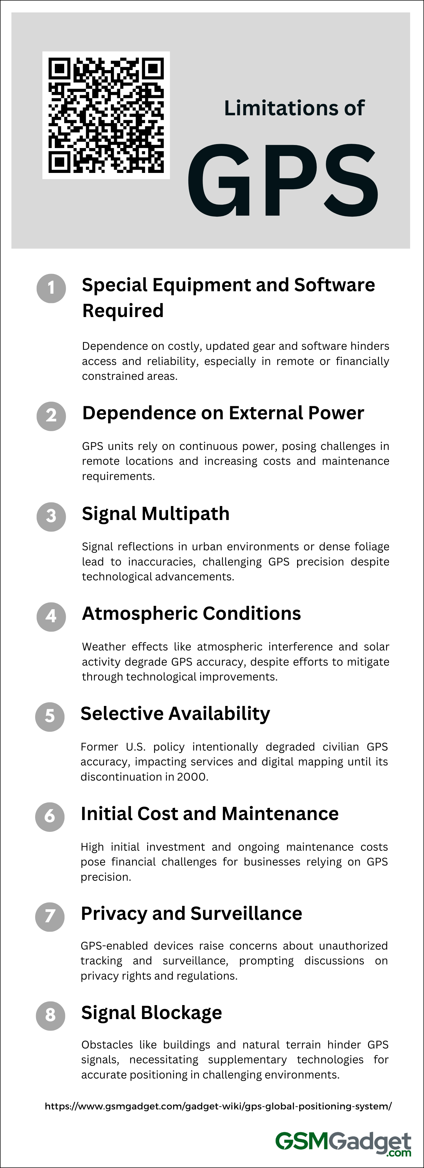
1. Special Equipment and Software Required
Even though GPS is handy, it works well only if you have the right gear and software. You need a GPS receiver, which can be a simple handheld device or part of your car or phone, to pick up signals from satellites. This device has to work with the latest software that gives you correct directions and new maps. Getting all this tech and keeping it updated can cost a lot and might be hard for some people to get. Also, problems like losing signal in far north places, the risk of someone messing with the signal (called spoofing), and bad weather make it even more important to have good equipment. This could make it tough for folks or groups who don’t have much tech or money to use GPS.
2. Dependence on External Power
GPS, crucial for navigation and tracking, has a big drawback: it needs power from outside sources. GPS units have to stay connected with satellites, which means they always need electricity. This is tough in far-off places where power is hard to find. Users face issues like relying on batteries, having to charge them often, and dealing with the waste from used batteries. How well GPS works depends on having power, so people need to think about other ways to keep their devices running. They also have to deal with higher costs and more upkeep.
3. Signal Multipath
GPS accuracy faces a big challenge from signal multipath, especially in places with lots of reflections like city streets or inside buildings. This problem happens when GPS signals bounce off things like buildings, mountains, or big vehicles. This can cause delays and create ‘ghost’ locations that are different from the real spot. These mistakes can mess up where you think you are by a few meters or even more, making it hard to rely on navigation. Even though modern GPS devices use better antennas and smart ways to process signals to lessen these issues, they still struggle in places with tall buildings or lots of trees. Despite efforts to tell the difference between straight and bounced signals, these multipath effects remain a big hurdle for GPS systems trying to be exact in tricky spots.
4. Atmospheric Conditions
Weather can really mess with GPS accuracy. When signals from satellites pass through Earth’s atmosphere, they hit the troposphere and ionosphere. Here, things like temperature changes, pressure, wetness, and charged particles can slow down the signals or bend them. This can make GPS locations less accurate. Solar storms and magnetic shifts can make it even worse. We try to fix these issues with better tech, using two frequencies, and adding extra help systems. But since weather can be so unpredictable, including sudden effects from radomes, it’s tough to get perfect GPS precision.
5. Selective Availability
Selective Availability (SA) was a big limit on the Global Positioning System (GPS). The U.S. Department of Defense put it in place to make civilian GPS signals less accurate on purpose. They added random errors to the signals, so civilians could only get their location within about 100 meters. This was done to stop enemies from using the tech for military stuff. It made it hard to get precise locations for services that needed it. Plus, digital maps weren’t always right, and there wasn’t enough context info. In May 2000, they stopped using SA to make civilian GPS better, and the accuracy of devices got to around 20 meters. But the U.S. can still turn SA back on if they need to for national security. This shows how important it is to know about GPS’s weak spots and what policies mean for its use all over the world.
6. Initial Cost and Maintenance
GPS technology is crucial for navigation and tracking, but it has its downsides. The main issues are the high initial costs and ongoing maintenance. To start, you need to buy hardware like receivers and antennas, plus software to process data and integrate the system. Then, you have to keep paying for software updates, fixing or replacing hardware, and making sure signals are strong despite weather and atmosphere changes. These costs can really add up, especially when you need trained people to run the system. Companies that rely on accurate location info must think hard about whether the precision of GPS is worth the money they’ll spend over time.
7. Privacy and Surveillance
GPS tech in our everyday gadgets, like phones, smartwatches, and cars, makes getting around super easy. But it also raises big privacy concerns. From police to companies, and even people with bad intentions, they can get their hands on your GPS info. They might track you or figure out your habits without you saying okay or them having a legal reason to do so. This kind of tracking starts a lot of talks about privacy rights, how it could be misused, and whether it’s right or wrong. We need to find the sweet spot between enjoying the perks of GPS and keeping our personal space private. That means we’ve got to make some tough rules and create tech that keeps our whereabouts safe from prying eyes.
8. Signal Blockage
The Global Positioning System (GPS) has changed how we navigate and keep time. But it has its limits. Sometimes, GPS signals get blocked and can’t give us accurate location info. Tall city buildings, mountains, dense forests, or being inside or underground can block these signals. This causes errors because the signal might bounce off or bend around things. It’s a big problem for tools that need to know exactly where they are, like those that control a car’s speed by talking to its Electronic Control Unit (ECU). To fix this, we’ve come up with extra tech like Assisted GPS (A-GPS) and other ways to find out where we are. These help make sure GPS works well everywhere.